Video of another tree that goes down into the hole. Yesterday they released a video show a bunch of trees being sucked down. Watch how this tree goes down, leans over and then straight up and down into the hole. It is a tall tree too.
The sinkhole is 40+ acres large now.
Yesterday's video and information is here.
Update Flyover from today 8/22/13
Showing posts with label bayou corne. Show all posts
Showing posts with label bayou corne. Show all posts
Thursday, August 22, 2013


Wednesday, August 21, 2013
Video Assumption Parish, Louisiana Bayou Corne Sinkhole 8/21/13 of Trees being sucked into hole
This is the first time I have seen a video of the trees being literally sucked into the sinkhole today.
They had first put out a situation report that there was no activity this morning, then they released the fact that all work had stopped on the sinkhole due to a burp event.
This was not a burp event shown on the video, it is of trees being sucked into the hole and never to be seen again.
UPDATE - NEW VIDEO 8/22/13 - video shows another tree go down into the hole.
Here is the flyover from the 13th of August. You can see oil and carbon residue on the top of it. They keep redoing the roads around here when the sinkhole eats them. You can see the roads are not as they use to be. Also you can see all the water on the other side of the roads at one point in the video.
They had first put out a situation report that there was no activity this morning, then they released the fact that all work had stopped on the sinkhole due to a burp event.
This was not a burp event shown on the video, it is of trees being sucked into the hole and never to be seen again.
UPDATE - NEW VIDEO 8/22/13 - video shows another tree go down into the hole.
Here is the flyover from the 13th of August. You can see oil and carbon residue on the top of it. They keep redoing the roads around here when the sinkhole eats them. You can see the roads are not as they use to be. Also you can see all the water on the other side of the roads at one point in the video.
Wednesday, March 13, 2013
Long duration Earthquakes and large burst quakes, Bayou Crone Sinkhole in Assumption Parish La. Update
Here is the update for Bayou Corne, there are long duration quakes happening. Assumption Parish said there was a burst overnight. Everything is in the video, including the seismic graphs.
I have many update articles on the blog about the Sinkhole and will continue to update the information as I am able to find out more. I believe it is something people should be aware of. The MSM has not yet mentioned this problem, so it is up to each of us to inform others of what is happening.
I have many update articles on the blog about the Sinkhole and will continue to update the information as I am able to find out more. I believe it is something people should be aware of. The MSM has not yet mentioned this problem, so it is up to each of us to inform others of what is happening.
Monday, March 4, 2013
Bayou Corne - Homes cracking from Earthquakes, Gov. Jindal has ignored Sinkhole and people, Erin Brokovich getting involved.
 |
| Bayou Corne Sinkhole on August 8th 2012 |
 |
| Bayou Corne Sinkhole February 2013 |
The Bayou Corne sinkhole is not going away, in fact it is getting worst every day. They stopped all work last week due to all the earthquakes that are happening in the area. I have written about it many times over the last few months.
The officials of Assumption Parish have not made Texas Brine buy all the people's property, who have been displaced for 7 months now.
It is fu**ing obvious the situation is not going to get better, as the sinkhole continues to get bigger everyday. yet they still ignore the people.
One person who has ignored the whole sinkhole and plight of the people who live in the Bayou Corne area is Governor Jindal. He has never publicly acknowledged the sinkhole. Last week his office finally released a statement saying they were aware of the situation. The governor has never visited Bayou Corne nor has he shown support for the people.
To me if it is being ignored by elected officials, it must be worse than what is even being told. That means the situation is so bad that they will ignore it, so big oil and chemical companies do not get bad national media attention. After all Governor Jindal is bought and paid for by the big oil and chemical corporations and they run the governor in what he can do and say. Governor Jindal is a puppet for the corporations.
The people who live around there, houses are cracking up from all the earthquakes. Of course USGS does not acknowledge all the quakes of the area on the map. They too are ignoring what is happening at Bayou Corne. The only place to see the Earthquakes happening is on this site.
Those people have been ignored by everyone, including all their elected officials and the national media. Only local media has had anything about the sinkhole and the people in the area being evacuated 7 months ago.
The people of the area are now, finally going to get some attention from a big name. Erin Brokovich is going to meet with the people of Bayou Corne on March 8th. I sincerely hope from there, she will command some form of attention to this from the national media and get those people bought out by Texas Brine, who is the ultimate blame for the sinkhole caving in.
Portion:
Sunday marked the 7 month anniversary of the formation of a massive sinkhole in Bayou Corne. Erin Brockovich and Tom Girardi will attend a community meeting on Saturday, March 9. Resident's say Brockovich, an environmental activist, could help bring national attention to the community.
"I hope she brings some national attention, someone to scrutinize what's going on here, because we are in desperate need," Kenny Simoneaux, Bayou Corne resident, explained.
The sinkhole is now an estimated 9 acres, it has been stated it could be 40 acres of a sinkhole before it is finished growing. Methane gas has been being released all around Bayou Corne in different spots, imagine having to live around there and most likely dying a slow death from breathing in all the toxins in the air.
Portions:
Geophysicists say the cavern that caused the sinkhole at the surface is still collapsing, leaving Bayou Corne residents wondering if there will ever be an end in sight.
“The cavern was 3,400 feet deep, which is deeper than any known cavern failure impacting the surface in the international record,” Hecox said.
Nowhere in the world has a brine cavern this large collapsed, and Hecox said the data shows it's not finished yet.
“It appears that the sand and gravel that's in the bottom of the sinkhole breaks up a large gas bubble into many small bubbles just like an aquarium,” Hecox said, “That is a good thing. Because if you get a single bubble up and have an ignition source, you can have a flash over.”
A flash over is an explosion, like the kind you can see if you leave the gas on too long before lighting a propane grill. But Hecox said a large natural gas bubble from the sinkhole lit by any ignition source could mean major damage on the surface.
Instead, those little bubbles are coming out all around the actual sinkhole site in the form of bubble sites in the bayou. Twenty new bubble sites have been spotted in the last month.
Many feel forgotten, Weber said. Especially by Gov. Bobby Jindal. The governor has yet to visit the sinkhole site or publicly talk about it.
“He's promoting plants around the area, chemical plants. And he was in the area, and he wouldn't, still to this day does not acknowledge it,” Weber said.
As photos from the Louisiana Environmental Action Network show, when the sinkhole first appeared, it was just 400 feet in diameter. As of mid-February, it had swallowed nine acres. Scientists say the worst-case scenario is it could swallow 40 acres.
Wednesday, February 27, 2013
Bayou Corne Sinkhole, All work stopped due to Earthquakes
http://folkworm.ceri.memphis.edu/heli_temp/
http://www.wwltv.com/news/local/Work-at-Assumption-sinkhole-suspended--193461611.html
Thursday, February 21, 2013
Finally! A New Bayou Corne Sinkhole Videos after 2 weeks without one.
Over 2 weeks no video of Bayou Corne has been released. They finally released one yesterday. You can see the situation is not good.
It appears, they are trying to build levees around the sinkhole. Watch the buildings in the back with the tanks. The sinkhole is getting bigger and bigger, there was a report that 5000 more square feet of trees fell, a few days ago into the hole.
It appears, they are trying to build levees around the sinkhole. Watch the buildings in the back with the tanks. The sinkhole is getting bigger and bigger, there was a report that 5000 more square feet of trees fell, a few days ago into the hole.
Thursday, January 31, 2013
Today's 1/31/13 Flyover of Bayou Corne Sinkhole, Assumption Parish Louisiana
Here is today's flyover of Bayou Corne Sinkhole. Watch the buildings in the back towards the end you can see the amount of water that is up to the buildings. You can also see how the pad does not have much on it, except in the back area of it.
Monday, January 21, 2013
New bubbling spot: Emergency workers calls "Mother of All Bubbles" Close to Bayou Corne Sinkhole.
There is a new bubbling spot that emergency workers are calling "Mother of All Bubbles"
It is methane gas. The gas is all around the area and has been bubbling in the bayous since last summer. This is the biggest and most active bubbling spot that has just appeared.
ASSUMPTION PARISH, LA (WAFB) -
It is methane gas. The gas is all around the area and has been bubbling in the bayous since last summer. This is the biggest and most active bubbling spot that has just appeared.
ASSUMPTION PARISH, LA (WAFB) -
Assumption Parish officials said the most recent bubbling site near the Bayou Corne sinkhole is the biggest pool they have seen yet. Office of Emergency Preparedness workers refer to it as the "mother of all bubbles."
The new bubbling site is an estimated 3,000 feet away from residences and camps.
Here is an article I did the other day 1/19/13 about the pad of the sinkhole having to be evacuated and a flyover after the "burp" of it.
WAFB 9 News Baton Rouge, Louisiana News, Weather, Sports
Here is an article I did the other day 1/19/13 about the pad of the sinkhole having to be evacuated and a flyover after the "burp" of it.
Saturday, January 19, 2013
Pad At Bayou Corne Sinkhole being evacuated of Equipment. Cracking and "Event/Growth/Burp" Happening today 1/19/13 UPDATED with Flyover 1/19/13
UPDATE 1/20/13 video of Flyover from 1/19/13 after "Event/burp/growth." Amazing the embedding option is still available so I am able to embed it here. You can see how the pad is being taken over by the sinkhole in the video.
Assumption Parish site has information of a "burp/event" happening today and growth of the Bayou Corne Sinkhole. There was also increased seismic activity before the "burp" of the sinkhole that brought up debris and oil.
The pad that is at the sinkhole is being evacuated of equipment and personnel due to cracks that are happening and a growth event.
I wrote about the sinkhole and had done a video about it, 2 days ago. They had not done a flyover since the 27th of December. I found they had a new flyover up a couple of hours after I did my video.
The initial information this morning:
Here is the update on it today, no flyover video yet to show the growth.

View more pictures here.
I hope they release another flyover. I showed in my video how the water/sinkhole was approached two buildings that were close to the sinkhole and had begun surrounding it, besides the major seismic activity of the area.
Here is an upclose picture from 12/11/12 of the buildings I focus on in the video above. It shows the water surrounding them over a month ago.
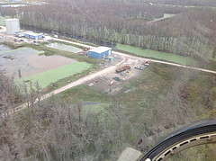
Assumption Parish site has information of a "burp/event" happening today and growth of the Bayou Corne Sinkhole. There was also increased seismic activity before the "burp" of the sinkhole that brought up debris and oil.
The pad that is at the sinkhole is being evacuated of equipment and personnel due to cracks that are happening and a growth event.
I wrote about the sinkhole and had done a video about it, 2 days ago. They had not done a flyover since the 27th of December. I found they had a new flyover up a couple of hours after I did my video.
The initial information this morning:
There has been increased seismic activity near the cavern this morning as well as developments of cracks on Oxy 3 pad. At approximately 10:00 this morning, another burp occurred in the sinkhole. The State Police helicopter has arrived to provide aerial viewing. Additional information will be posted as it becomes available.
Here is the update on it today, no flyover video yet to show the growth.
The Office of Conservation, in consultation with Assumption Parish Incident Command, is advising that the Texas Brine facility sinkhole appears to be undergoing a growth event, indicated by a recent upswing in measured seismic activity that began to decrease about the time of this morning’s release of debris and crude oil to the top of the sinkhole, as well as the appearance of cracks on the surface of the Oxy 3 well pad, located directly above Texas Brine’s failed cavern and on the eastern side of the sinkhole.
Monitoring of seismic activity and direct field observations from ground level and overflights are part of the ongoing response to determine the potential extent of this latest growth event – one of several observed since the formation of the sinkhole. Observations indicate that the current growth event is centered on the east side of the sinkhole – possibly related to shifting of salt and material within the cavern collapse zone. After a period of heightened activity, the number and strength of sharp seismic events dropped markedly following the release of debris and hydrocarbons from the sinkhole – though impacts at the surface on the eastern side of the sinkhole will continue to be monitored closely.
Following the appearance of the well pad surface cracks on the southwestern corner of the Oxy 3 well pad, the Office of Conservation advised that personnel and equipment should be removed from the site to ensure safety while observation and analysis of the growth event are ongoing.
Though the exact timing and extent of episodic growth events cannot be predicted, the Office of Conservation and its consultants had identified the Oxy 3 well pad as being within the area of potential sinkhole growth, and has maintained constant monitoring of subsurface conditions and activity for signs of instability in order to act quickly to protect the safety of the public and workers on site.
Here is one picture of the activity. Most of the monitors for today and yesterday are blank. This one is from yesterday.

 |
| Pad is the area with all the equipment. Notice all the water around the buildings now on the right. That area use to be all dirt, without water. This picture was taken 2 days ago 1/17/13. |
View more pictures here.
I hope they release another flyover. I showed in my video how the water/sinkhole was approached two buildings that were close to the sinkhole and had begun surrounding it, besides the major seismic activity of the area.
Here is an upclose picture from 12/11/12 of the buildings I focus on in the video above. It shows the water surrounding them over a month ago.

Thursday, January 17, 2013
Bayou Corne, Assumption Parish, La. No Flyover since 12/27/12. It had been growing exponentially. Video I made showing the differences and seismic activity
I watch the Bayou Corne site constantly. I am subscribed to their video channel on youtube. I have noticed and confirmed they have not had a flyover video since 12/27/12. They flyover it twice a week from what the website said a couple of months ago, on Tuesdays and Thursdays.
The last videos showed that the sink hole was growing exponentially. I have not written about it in awhile due to so many other things happening, but I still watched it almost everyday.
The videos do not allow embedding anymore. I guess that is because too many people were showing how it was growing fast and taking over the area.
Here is the Helicorder site that monitors the seismic activity.
Please forgive me as I am not a savvy video person. I don't know how to create great or slick videos. I do try to get information out though so I do the best I can.
I show through this video how the buildings in the backiground had been being taken over. This also has the latest seismic activity of the area.
UPDATE: They released a flyover today 1/17/13 - Watch it (won't let me embed) here.
Notice how the water it at the buildings now.
The last videos showed that the sink hole was growing exponentially. I have not written about it in awhile due to so many other things happening, but I still watched it almost everyday.
The videos do not allow embedding anymore. I guess that is because too many people were showing how it was growing fast and taking over the area.
Here is the Helicorder site that monitors the seismic activity.
Please forgive me as I am not a savvy video person. I don't know how to create great or slick videos. I do try to get information out though so I do the best I can.
I show through this video how the buildings in the backiground had been being taken over. This also has the latest seismic activity of the area.
UPDATE: They released a flyover today 1/17/13 - Watch it (won't let me embed) here.
Notice how the water it at the buildings now.
Wednesday, October 24, 2012
Dave Hodges, Commonsense Show - Connecting the dots of Bayou Corne with BP oil leak. Methane traveling - "Louisiana Coast to be evacuated?"
I have continually written about Bayou Corne and the situation there. Yesterday I had the videos up and the recent seismo graphs showing all the EQs going on.
Dave Hodges of the Commonsense radio show on Republic broadcasting, now has a website for his show. He is a friend of mine and I have been on his radio show a couple of times about the foreclosure fraud.
He wrote a hard hitting piece about Bayou Corne and the sinkhole there. He connected the dots to what has been going on in the Gulf of Mexico and the BP oil leak. He puts the corexit, methane and sinkholes together.
Remember Jesse Ventura's Truth show about the billions that has been set aside to evacuate the Gulf Coast regions. The full episode is here on youtube.
He has given me permission to reproduce his article in full on this site about what he sees is happening.

Political language is designed to make lies sound truthful and murder respectable.”
The conditions in the Gulf Coast region are so bad, that some are actually talking about a mass evacuation of the coastal regions in Louisiana. Others think the potential devastation is so dangerous that the entire Gulf Coast region should be evacuated. Others think that all is well in the Gulf. What exactly is the truth?
I have been investigating the events surrounding the Gulf Coast oil explosion for over two years. As I sit here mulling over the evidence which is derived from the full spectrum of research protocols ranging from anecdotal evidence to scientific evidence to government acknowledgment of a series of crises which appears to be imperiling Louisiana, I do not pretend that I have all the answers. However, after systematically reviewing the available evidence, I am extremely fearful for the potential consequences which could be catastrophic for many of the 40 million residents in the Gulf.
This topic has largely been swept under the covers by the Obama administration and the mainstream media, with a few exceptions. In this article, it is my intention to bring forth legitimate concerns for public discussion with regard to the safety and welfare of Gulf Coast residents, especially for those people living in Louisiana’s coastal areas.
The government would have us believe that all is well in the Gulf. In
fact, two years ago, the Environmental Protection Agency’s (EPA)
through its air monitoring system, on June 10, 2010, presumably found
air quality levels which were “normal” on the Gulf coastline. Of course this is the same EPA whose former director, Todd Christy, boldly stated that the post 911 air was fit to breathe. Also, in June 2010, Obama’s personal point man on the spill, Thad Allen, stated “the well no longer posed any threat to the Gulf”
and subsequent cleanup crews ceased all remaining operations with
regard to cleaning up the destroyed oil well. Thad Allen’s statement
followed Obama’s declaration in which the President boldly proclaimed that the Gulf is safe and “open for business”. Officials from both the Food and Drug Administration (FDA) and the EPA
echoed Obama’s safety claims. And what I have discovered from the data,
is that everyone of these government individuals, who are entrusted
with ensuring the safety of the general public, was lying through their
teeth.
 There were strong and early indications that the use of Corexit,
combined with the leaking oil, were producing, both long term and short
term, catastrophic environmental and individual health effects. Oil and
Corexit, used to “disperse” the oil spill have impacted untold numbers
of Gulf residents’ health. Additionally, both the food supply and the
food chain are being adversely impacted. The air and the subsequent evapotranspiration cycle
has been irreversibly altered which, in turn, impacts the water table
and the safety of water supplies as well as the safety of crops. The
most devastating finding relates the events of the oil spill to the
phenomena of the ever-widening Louisiana sinkholes and the related
underground explosions as well as the very high concentration of toxic
and highly flammable methane in the air and in the water.
There were strong and early indications that the use of Corexit,
combined with the leaking oil, were producing, both long term and short
term, catastrophic environmental and individual health effects. Oil and
Corexit, used to “disperse” the oil spill have impacted untold numbers
of Gulf residents’ health. Additionally, both the food supply and the
food chain are being adversely impacted. The air and the subsequent evapotranspiration cycle
has been irreversibly altered which, in turn, impacts the water table
and the safety of water supplies as well as the safety of crops. The
most devastating finding relates the events of the oil spill to the
phenomena of the ever-widening Louisiana sinkholes and the related
underground explosions as well as the very high concentration of toxic
and highly flammable methane in the air and in the water.
One of the major threats to the Gulf Coast comes from an imperiled food supply which is the result from the explosion on the Deep Water Horizon oil rig.
It was known very early on that the Gulf Coast food supply was
severely compromised and the health of the residents was in jeopardy,
despite government denials and mainstream media cover-ups. A case in
point, while dining with his family at Vinnie’s Raw Bar Restaurant in
the Charlotte, North Carolina area, Matthew Robertson found oil in his
seafood. While covering the story, WBTV reporter Sarah Batista
also acknowledged there was a black substance stuck to the inside of
Robertson’s sea food. Additionally, Channel 8, Fox News, Winston-Salem,
North Carolina, was told by Vinnie’s Raw Bar restaurant’s manager that
he did, indeed, confirm the customer’s story and says he’s had problems
getting oyster shipments because of contamination resulting from the oil
spill, unfortunately, this station saw fit to scrub the report from its
website. However, similar warnings regarding the region’s food safety
are appearing up and down the local Gulf Coast media on such stations as
WLOX TV
in Gulfport, MS. Yet, Fox, CNN, CBS, ABC, NBC, etc., have not run one
credible story on the dangers of food toxicity in the Gulf’s food chain.
Granted, the abovementioned cases represent just a few anecdotal cases
which are representative of tens of thousands of accounts. However,
anecdotal evidence is not science and these cases could be discounted as
the exception and not the rule. Yet, the largely ignored voices of
scientists echo these anecdotal claims and they do so with hard,
verifiable data.
Scientists at The University of Southern Mississippi and Tulane
University have found oil in the post-larvae of blue crabs entering
coastal marshes along the Gulf Coast signaling that oil may be entering
estuarine food chains. Dr. Perry observed that “I have never seen anything like this.”
Larvae is at the bottom of the food chain. Lesser life forms, are
consumed by life forms which are higher on the food chain and the toxic
effects of the Corexit will bioaccumulate throughout the food chain.
This conclusion echoed the findings of lab samples taken by scientists
at the Dauphin Island Sea Lab
shows oil from the Deepwater Horizon disaster has made its way into the
Gulf food chain as well. These particular scientists have found signs
of an oil-and-dispersant mix under the shells of tiny blue crab larvae
in the Gulf of Mexico which is a clear indication that the unprecedented
use of dispersants in the BP oil spill has broken up the oil into toxic
droplets so tiny that they have easily entered the food chain.
These studies and other similar studies remain unchallenged by the
authorities with regard to methodology and results. In short, the Obama
administration is choosing to ignore these credible scientists by simply
repeating the mantra that “all is well” in the Gulf of Mexico.
Kim Anderson’s Oregon State University (OSU) researchers, from the
OSU College of Agricultural Sciences, began a test-retest comparative
analysis for the carcinogenic contaminant polycyclic aromatic
hydrocarbons (PAHs), and its biodegradable partner, OPAHs, which appears
after the application of Corexit and subsequent exposure to ultraviolet
rays. Stunningly, the OSU researchers found a 40 fold increase in these carcinogenic compounds
in the comparative test-retest period. The OSU findings replicate the
conclusions of Mace Barron et al regarding the toxicity of Corexit and
its use in the Exxon Valdez oil spill. The Exxon Valdez oil spill and
subsequent clean-up activities provides the only case study in the
history of the United States involving significant exposure to the types
of toxins discussed in this article as the result of an oil spill.
Interestingly, Anderson’s Oregon State University’s original data went
missing forcing the research team to begin again. It is clear that
somebody did not want this data to reach the public.
 Findings, related to the longevity of the Exxon Valdez clean-up
workers, are very disturbing as the collective lifespan statistics, for
the Corexit exposed cleanup crews, revealed that the average life expectancy is a mere 51 years of age and nearly all of the Exxon Valdez clean-up workers are dead.
These findings can leave little doubt that BP’s use of Corexit has
seriously compromised the collective life span of Gulf Coast residents. I
can draw no other conclusion than to state that the events in the Gulf,
to date, constitute a slow-burn genocidal event in which, depending on
the age at first exposure to the Corexit, the oil and the resulting
methane concentrations, will see life spans in the impacted areas
decline by as much as 25-50% with regard to longevity based upon the
life-span figures from the Exxon Valdez clean-up workers. I believe that
based upon the data, it is reasonable to assume that within one short
generation, the life expectancy of the Gulf will rival the worst of the
third world.
Findings, related to the longevity of the Exxon Valdez clean-up
workers, are very disturbing as the collective lifespan statistics, for
the Corexit exposed cleanup crews, revealed that the average life expectancy is a mere 51 years of age and nearly all of the Exxon Valdez clean-up workers are dead.
These findings can leave little doubt that BP’s use of Corexit has
seriously compromised the collective life span of Gulf Coast residents. I
can draw no other conclusion than to state that the events in the Gulf,
to date, constitute a slow-burn genocidal event in which, depending on
the age at first exposure to the Corexit, the oil and the resulting
methane concentrations, will see life spans in the impacted areas
decline by as much as 25-50% with regard to longevity based upon the
life-span figures from the Exxon Valdez clean-up workers. I believe that
based upon the data, it is reasonable to assume that within one short
generation, the life expectancy of the Gulf will rival the worst of the
third world.
In addition to imperiling the food supply, the Gulf disaster is
overwhelming the environment and threatens to bring disaster to the
southeastern portion of the United States on an unprecedented scale. The
holocaust in the Gulf has grown to such proportions that the European Union Times reports that an extremely grave report was prepared for President Medvedev by Russia’s Ministry of Natural Resources
in which the report warns that the BP spill will become the worst
environmental catastrophe in all of human history and will bring total
destruction to the Eastern half of the North American continent. The
environmental damage has spread as far north as Memphis as local
residents report toxic rainfall,
containing Corexit, is falling on and damaging local farmers crops.
This report aired over two years ago and was among the first indicators
that the evapotranspiration will cycle was being impacted by the
Deepwater Horizon explosion and the subsequent use of Corexit to
“disperse” the spilled oil.
The oil emanating from the seafloor contains about 40% methane, compared with about 5% found in typical oil deposits, said John Kessler, a Texas A&M University oceanographer who is studying the impact of methane from the spill. Kessler et al, in June of 2010, warned the public that methane was not going to dissipate on its own and that it would continue to increase and come ashore with unpredictable results. Merchant Marine expert, Captain Kelly Sweeney, while appearing on The Common Sense Show, on July 10, 2010, made similar predictions in which he stated that he and many of his sources feared catastrophic methane explosions near several coastal cities which could be triggered by the right atmospheric conditions combined with the high levels of highly flammable methane (click here to listen to Hour 1).
Unfortunately, nobody predicted the scenario which is unfolding across several Louisiana communities in which high concentrations of methane laden oil has made its way into the salt domes and into the water table constituting a significant threat millions of Gulf Coast residents.
John Boudreaux, director of the Assumption (LA.) Parish Office of Homeland Security and Emergency Preparedness has said there are concerns that the gas can build pressure under the clay layer that lies above their local aquifer. According to Boudreaux and geologists, once the aquifer reaches a pressure greater than 75 to 85 pounds per square inch, the clay layer might not hold back the accumulated gas and a set of major explosions could occur. Recently, something unexpectedly triggered an emergency flare 40 feet high at that Crosstex well last week. An explosion of this magnitude would be within the range of one and a half B83 thermonuclear (hydrogen) bombs, according to scientists. On 9/11 of this year, Louisiana officials suddenly and without comment banned outdoor fires. Ray Charles could see these dots connecting on the wall.
In July 2010, BP found a mega pocket of highly pressurized methane gas in the Gulf of Mexico. The EPA and the President chose to ignore the publicized findings. Nobody in the mainstream media bothered to speculate as to the potential dangers. Publicly, the federal government did not answer the obvious questions, namely, where are the concentrations of the mega pocket of highly pressurized methane gas likely to migrate to and what would be the ultimate effect? It has been 27 months since this discovery, and the public is expected to believe that BP and the government had no idea of the ramifications of the discovery of this magnitude. This flies in the face of believability!
As Gulf Coast investigator, Dr. Wilma Subra stated, that the oil/Corexit is in “…the air, the water table, the sea floor sediment, the shallow surface of the beach, it is in the estuaries,… it is in the water column at 3,000-4,000 foot depth, the prevailing winds bring in the oil/Corexit to the shores and the substances are deposited inland. ..The environmental impact will last for generations.” The people of Bayou Corne, as well as at least 28 other Louisiana communities near the coast, are finding out how accurate Dr. Suber’s observations, offered in February of 2011, truly were.
The massive sinkhole and enormous amount of escaping methane gas from the Bayou Corne disaster area is particularly concerning. Local officials have made repeated references to, “powerful underground forces”, which are causing the monster sinkhole in the swampland, which subsequently bent a gas pipeline which then formed a shocking right angle in a 400-foot section next to the bubbling hole. Ultimately, this led to the evacuation of 150 homes, temporarily shutting down a four-mile stretch of nearby Highway 70, and led to a heated discussion regarding the likelihood of a methane-bubble tsunami from the 2010 Gulf of Mexico BP explosion. Government officials warned the Parish President that the Bayou Corne sinkhole has extremely high levels of methane in the nearby water wells. Subsequently, officials have warned the local leadership that these high levels of methane pose serious risks to health, fire and could even lead to large explosions. Officials have further warned that local residents needed to obey coming mandatory evacuation orders. However, the mass evacuation expected to occur last week, has unexplainably not been acted upon.
After looking at the government’s own data and examining the totality of government’s actions, I have concluded that the government is acting with extreme depraved indifference with regard to the citizen’s health near the 28 sinkholes. Let me be crystal clear about one point, methane kills and it can kill silently if exposure occurs in sufficient quantities. Even if the people in Louisiana, near the 28 reported sinkholes, were to, by the grace of God, able to somehow escape lethal exposure, methane in smaller doses can still mimic other health conditions and can fool a general medical practitioner but the conditions could still lead to a person’s demise. The latter fact related to methane exposure mimicking other health conditions works to the government’s and BP’s benefit because it temporarily provides them with plausible deniability. We have witnessed this same strategy as the BP health mobile health clinics, designed to treat local victims of the spill and exposure to Corexit, were purposely misdiagnosing clear cases of Corexit toxicity to escape the liability consequences.
There is no defense against leaking methane. No residential building is secure enough to keep the methane from penetrating homes and offices. Methane has been proven to enter structures through foundational cracks or through sewer traps if the house or office is built on or near landfills, and in the case of Louisiana, it can come through salt domes where the oil and the Corexit has been accumulating for nearly two and a half years.
Methane gas can also be ingested. Originally thought to be a remote possibility, methane gas can migrate into the natural water reservoirs. Yet, this is exactly what has happened. And these precise conditions are serving to impact the drinking water supplies as well as the safety of area crops because of the evapotranspirational cycle. This is not a predicted event in Louisiana, it is exactly what is happening right now.
The only way to determine that someone has been exposed to methane, is through extensive laboratory analysis conducted by trained medical personnel. In the event of methane exposure, the only way for the victim to escape with only minimal medical consequences, is to be rushed to a nearby hospital without delay. The victim would have to be put on an immediate supply of oxygen along with a life support mask and this would be accompanied by an intravenous drip to avoid further dehydration.
Please allow me to connect some dots with regard to the previous paragraphs. On April 20, 2010, the Deepwater Horizon oil rig exploded. For over two years, large concentrations of carcinogenic material and highly flammable methane gas has been bio-accumulating in the estuaries, the beaches, the water table, the salt domes and this event is now part of the evapotranspirational cycle. In other words, these toxic conditions are now ingrained in the eco-weather system in the Gulf and federal officials sit idly and are doing nothing to ensure public safety.
From the work of people like Dr. Subra, researchers at Oregon State University, Tulane University and the University of South Florida, we now know that millions of people have been exposed to abnormally high rates of benzene, xylene and other cancer-causing chemicals. The public has been warned by the alternative media, and a few outspoken members of the mainstream media as well as a plethora of geologists, chemists and oil experts that large amounts of methane was making its way ashore in the Gulf Coast region. The resulting sinkholes, which are still greatly expanding as of this writing, and the large amounts of methane gas escaping into the air as well as infiltrating the water table, are placing untold numbers of Gulf Coast residents in a very dire set of circumstances.
When I first spoke out on my show and in my writings, in 2010 and in 2011, about the dangers of methane and what it could possibly mean for the Gulf, I was referred to as an alarmist in some mainstream media circles. To those critics who still hold to these allegations that I am fear mongering for whatever personal or professional benefit, please explain the meaning of following warning to me: The Louisiana Department of Natural Resources (DRN) has issued a Declaration of Emergency and Directive Advisory which states that the gas in the sinkhole area should be considered to be life-threatening. Does the mainstream media have a new definition of the term “life-threatening” which would cause them to all but ignore this ominous warning? I would ask the critics, the federal government, and BP to explain away the connections between the scientific facts, the warning that the conditions in Louisiana are life-threatening and the subsequent ban on fires by government officials. Then, when they are done trying to explain away the DRN warning, perhaps they would like to address the passage of mass fatality planning legislation contained in H.R. 6566 which amends the Homeland Security Act of 2002 by requiring the Administrator of the Federal Emergency Management Agency…”to provide guidance and counseling for mass fatality planning, and for other purposes. And while the federal government is at it, perhaps they would like to explain the coincidental timing of the FEMA earthquake preparedness drills taking place along the New Madrid fault line which is precisely where some of the methane laden oil and Corexit is migrating to. Just a coincidence you say? Then maybe those people who are hell bent on staying in a state of denial, can explain why FEMA thinks that Louisiana needs massive amounts of generators to be sent to the region at taxpayers’ expense? How many coincidences can one accept until an unmistakable pattern of cover-up and criminal neglect, on the part of the government, becomes painfully obvious to even the most ardent of the Kool-Aid drinkers?
Should the coastal regions of Louisiana be evacuated? We have certainly seen the proof that government officials have actually announced plans to evacuate many areas around the sinkholes, only to change their minds without explanation. This leads one to wonder if the government is trying avoid a mass panic and they are hoping for the best without preparing for the worst. After all, the election is only a couple of weeks away and the crisis in the Gulf did happen on Obama’s watch.
 Personally, I think that the canary in the mine approach to this
phenomena would be best served if the President were to spend two or
three days campaigning in the Bayou country in and around coastal
regions, near the 28 sinkholes which are still expanding by the day.
Come on Mr. President, put your money where your mouth is, and prove to
the American people that the Gulf is indeed open for business.
And while you are at it Mr. President, order up some crab and shrimp.
And please make certain that you order and eat exactly what the locals
eat with no specially prepared dishes made just for you. Mr. President,
while you are in the Gulf, you should also take a deep breath and show
the people of the region, that despite your lack of a legitimate birth
certificate, that you are indeed one of them and you are willing to risk
your life in the same manner as you are asking them to do.
Personally, I think that the canary in the mine approach to this
phenomena would be best served if the President were to spend two or
three days campaigning in the Bayou country in and around coastal
regions, near the 28 sinkholes which are still expanding by the day.
Come on Mr. President, put your money where your mouth is, and prove to
the American people that the Gulf is indeed open for business.
And while you are at it Mr. President, order up some crab and shrimp.
And please make certain that you order and eat exactly what the locals
eat with no specially prepared dishes made just for you. Mr. President,
while you are in the Gulf, you should also take a deep breath and show
the people of the region, that despite your lack of a legitimate birth
certificate, that you are indeed one of them and you are willing to risk
your life in the same manner as you are asking them to do.

Dave Hodges of the Commonsense radio show on Republic broadcasting, now has a website for his show. He is a friend of mine and I have been on his radio show a couple of times about the foreclosure fraud.
He wrote a hard hitting piece about Bayou Corne and the sinkhole there. He connected the dots to what has been going on in the Gulf of Mexico and the BP oil leak. He puts the corexit, methane and sinkholes together.
Remember Jesse Ventura's Truth show about the billions that has been set aside to evacuate the Gulf Coast regions. The full episode is here on youtube.
He has given me permission to reproduce his article in full on this site about what he sees is happening.

Political language is designed to make lies sound truthful and murder respectable.”
George Orwell
The conditions in the Gulf Coast region are so bad, that some are actually talking about a mass evacuation of the coastal regions in Louisiana. Others think the potential devastation is so dangerous that the entire Gulf Coast region should be evacuated. Others think that all is well in the Gulf. What exactly is the truth?
I have been investigating the events surrounding the Gulf Coast oil explosion for over two years. As I sit here mulling over the evidence which is derived from the full spectrum of research protocols ranging from anecdotal evidence to scientific evidence to government acknowledgment of a series of crises which appears to be imperiling Louisiana, I do not pretend that I have all the answers. However, after systematically reviewing the available evidence, I am extremely fearful for the potential consequences which could be catastrophic for many of the 40 million residents in the Gulf.
This topic has largely been swept under the covers by the Obama administration and the mainstream media, with a few exceptions. In this article, it is my intention to bring forth legitimate concerns for public discussion with regard to the safety and welfare of Gulf Coast residents, especially for those people living in Louisiana’s coastal areas.
All Is Well, Go Back To Sleep
 There were strong and early indications that the use of Corexit,
combined with the leaking oil, were producing, both long term and short
term, catastrophic environmental and individual health effects. Oil and
Corexit, used to “disperse” the oil spill have impacted untold numbers
of Gulf residents’ health. Additionally, both the food supply and the
food chain are being adversely impacted. The air and the subsequent evapotranspiration cycle
has been irreversibly altered which, in turn, impacts the water table
and the safety of water supplies as well as the safety of crops. The
most devastating finding relates the events of the oil spill to the
phenomena of the ever-widening Louisiana sinkholes and the related
underground explosions as well as the very high concentration of toxic
and highly flammable methane in the air and in the water.
There were strong and early indications that the use of Corexit,
combined with the leaking oil, were producing, both long term and short
term, catastrophic environmental and individual health effects. Oil and
Corexit, used to “disperse” the oil spill have impacted untold numbers
of Gulf residents’ health. Additionally, both the food supply and the
food chain are being adversely impacted. The air and the subsequent evapotranspiration cycle
has been irreversibly altered which, in turn, impacts the water table
and the safety of water supplies as well as the safety of crops. The
most devastating finding relates the events of the oil spill to the
phenomena of the ever-widening Louisiana sinkholes and the related
underground explosions as well as the very high concentration of toxic
and highly flammable methane in the air and in the water. One of the major threats to the Gulf Coast comes from an imperiled food supply which is the result from the explosion on the Deep Water Horizon oil rig.
The Tainted Food Supply
The Quiet Voices of Science Assess Gulf Food Safety
Potential Effects on Life Span in the Gulf
An Environmental Armageddon in the Making
The oil emanating from the seafloor contains about 40% methane, compared with about 5% found in typical oil deposits, said John Kessler, a Texas A&M University oceanographer who is studying the impact of methane from the spill. Kessler et al, in June of 2010, warned the public that methane was not going to dissipate on its own and that it would continue to increase and come ashore with unpredictable results. Merchant Marine expert, Captain Kelly Sweeney, while appearing on The Common Sense Show, on July 10, 2010, made similar predictions in which he stated that he and many of his sources feared catastrophic methane explosions near several coastal cities which could be triggered by the right atmospheric conditions combined with the high levels of highly flammable methane (click here to listen to Hour 1).
Unfortunately, nobody predicted the scenario which is unfolding across several Louisiana communities in which high concentrations of methane laden oil has made its way into the salt domes and into the water table constituting a significant threat millions of Gulf Coast residents.
John Boudreaux, director of the Assumption (LA.) Parish Office of Homeland Security and Emergency Preparedness has said there are concerns that the gas can build pressure under the clay layer that lies above their local aquifer. According to Boudreaux and geologists, once the aquifer reaches a pressure greater than 75 to 85 pounds per square inch, the clay layer might not hold back the accumulated gas and a set of major explosions could occur. Recently, something unexpectedly triggered an emergency flare 40 feet high at that Crosstex well last week. An explosion of this magnitude would be within the range of one and a half B83 thermonuclear (hydrogen) bombs, according to scientists. On 9/11 of this year, Louisiana officials suddenly and without comment banned outdoor fires. Ray Charles could see these dots connecting on the wall.
In July 2010, BP found a mega pocket of highly pressurized methane gas in the Gulf of Mexico. The EPA and the President chose to ignore the publicized findings. Nobody in the mainstream media bothered to speculate as to the potential dangers. Publicly, the federal government did not answer the obvious questions, namely, where are the concentrations of the mega pocket of highly pressurized methane gas likely to migrate to and what would be the ultimate effect? It has been 27 months since this discovery, and the public is expected to believe that BP and the government had no idea of the ramifications of the discovery of this magnitude. This flies in the face of believability!
As Gulf Coast investigator, Dr. Wilma Subra stated, that the oil/Corexit is in “…the air, the water table, the sea floor sediment, the shallow surface of the beach, it is in the estuaries,… it is in the water column at 3,000-4,000 foot depth, the prevailing winds bring in the oil/Corexit to the shores and the substances are deposited inland. ..The environmental impact will last for generations.” The people of Bayou Corne, as well as at least 28 other Louisiana communities near the coast, are finding out how accurate Dr. Suber’s observations, offered in February of 2011, truly were.
The massive sinkhole and enormous amount of escaping methane gas from the Bayou Corne disaster area is particularly concerning. Local officials have made repeated references to, “powerful underground forces”, which are causing the monster sinkhole in the swampland, which subsequently bent a gas pipeline which then formed a shocking right angle in a 400-foot section next to the bubbling hole. Ultimately, this led to the evacuation of 150 homes, temporarily shutting down a four-mile stretch of nearby Highway 70, and led to a heated discussion regarding the likelihood of a methane-bubble tsunami from the 2010 Gulf of Mexico BP explosion. Government officials warned the Parish President that the Bayou Corne sinkhole has extremely high levels of methane in the nearby water wells. Subsequently, officials have warned the local leadership that these high levels of methane pose serious risks to health, fire and could even lead to large explosions. Officials have further warned that local residents needed to obey coming mandatory evacuation orders. However, the mass evacuation expected to occur last week, has unexplainably not been acted upon.
After looking at the government’s own data and examining the totality of government’s actions, I have concluded that the government is acting with extreme depraved indifference with regard to the citizen’s health near the 28 sinkholes. Let me be crystal clear about one point, methane kills and it can kill silently if exposure occurs in sufficient quantities. Even if the people in Louisiana, near the 28 reported sinkholes, were to, by the grace of God, able to somehow escape lethal exposure, methane in smaller doses can still mimic other health conditions and can fool a general medical practitioner but the conditions could still lead to a person’s demise. The latter fact related to methane exposure mimicking other health conditions works to the government’s and BP’s benefit because it temporarily provides them with plausible deniability. We have witnessed this same strategy as the BP health mobile health clinics, designed to treat local victims of the spill and exposure to Corexit, were purposely misdiagnosing clear cases of Corexit toxicity to escape the liability consequences.
There is no defense against leaking methane. No residential building is secure enough to keep the methane from penetrating homes and offices. Methane has been proven to enter structures through foundational cracks or through sewer traps if the house or office is built on or near landfills, and in the case of Louisiana, it can come through salt domes where the oil and the Corexit has been accumulating for nearly two and a half years.
Methane gas can also be ingested. Originally thought to be a remote possibility, methane gas can migrate into the natural water reservoirs. Yet, this is exactly what has happened. And these precise conditions are serving to impact the drinking water supplies as well as the safety of area crops because of the evapotranspirational cycle. This is not a predicted event in Louisiana, it is exactly what is happening right now.
The only way to determine that someone has been exposed to methane, is through extensive laboratory analysis conducted by trained medical personnel. In the event of methane exposure, the only way for the victim to escape with only minimal medical consequences, is to be rushed to a nearby hospital without delay. The victim would have to be put on an immediate supply of oxygen along with a life support mask and this would be accompanied by an intravenous drip to avoid further dehydration.
Please allow me to connect some dots with regard to the previous paragraphs. On April 20, 2010, the Deepwater Horizon oil rig exploded. For over two years, large concentrations of carcinogenic material and highly flammable methane gas has been bio-accumulating in the estuaries, the beaches, the water table, the salt domes and this event is now part of the evapotranspirational cycle. In other words, these toxic conditions are now ingrained in the eco-weather system in the Gulf and federal officials sit idly and are doing nothing to ensure public safety.
From the work of people like Dr. Subra, researchers at Oregon State University, Tulane University and the University of South Florida, we now know that millions of people have been exposed to abnormally high rates of benzene, xylene and other cancer-causing chemicals. The public has been warned by the alternative media, and a few outspoken members of the mainstream media as well as a plethora of geologists, chemists and oil experts that large amounts of methane was making its way ashore in the Gulf Coast region. The resulting sinkholes, which are still greatly expanding as of this writing, and the large amounts of methane gas escaping into the air as well as infiltrating the water table, are placing untold numbers of Gulf Coast residents in a very dire set of circumstances.
When I first spoke out on my show and in my writings, in 2010 and in 2011, about the dangers of methane and what it could possibly mean for the Gulf, I was referred to as an alarmist in some mainstream media circles. To those critics who still hold to these allegations that I am fear mongering for whatever personal or professional benefit, please explain the meaning of following warning to me: The Louisiana Department of Natural Resources (DRN) has issued a Declaration of Emergency and Directive Advisory which states that the gas in the sinkhole area should be considered to be life-threatening. Does the mainstream media have a new definition of the term “life-threatening” which would cause them to all but ignore this ominous warning? I would ask the critics, the federal government, and BP to explain away the connections between the scientific facts, the warning that the conditions in Louisiana are life-threatening and the subsequent ban on fires by government officials. Then, when they are done trying to explain away the DRN warning, perhaps they would like to address the passage of mass fatality planning legislation contained in H.R. 6566 which amends the Homeland Security Act of 2002 by requiring the Administrator of the Federal Emergency Management Agency…”to provide guidance and counseling for mass fatality planning, and for other purposes. And while the federal government is at it, perhaps they would like to explain the coincidental timing of the FEMA earthquake preparedness drills taking place along the New Madrid fault line which is precisely where some of the methane laden oil and Corexit is migrating to. Just a coincidence you say? Then maybe those people who are hell bent on staying in a state of denial, can explain why FEMA thinks that Louisiana needs massive amounts of generators to be sent to the region at taxpayers’ expense? How many coincidences can one accept until an unmistakable pattern of cover-up and criminal neglect, on the part of the government, becomes painfully obvious to even the most ardent of the Kool-Aid drinkers?
Should the coastal regions of Louisiana be evacuated? We have certainly seen the proof that government officials have actually announced plans to evacuate many areas around the sinkholes, only to change their minds without explanation. This leads one to wonder if the government is trying avoid a mass panic and they are hoping for the best without preparing for the worst. After all, the election is only a couple of weeks away and the crisis in the Gulf did happen on Obama’s watch.
Personally, I think that the canary in the mine approach to this
phenomena would be best served if the President were to spend two or
three days campaigning in the Bayou country in and around coastal
regions, near the 28 sinkholes which are still expanding by the day.
Come on Mr. President, put your money where your mouth is, and prove to
the American people that the Gulf is indeed open for business.
And while you are at it Mr. President, order up some crab and shrimp.
And please make certain that you order and eat exactly what the locals
eat with no specially prepared dishes made just for you. Mr. President,
while you are in the Gulf, you should also take a deep breath and show
the people of the region, that despite your lack of a legitimate birth
certificate, that you are indeed one of them and you are willing to risk
your life in the same manner as you are asking them to do.
Tuesday, October 23, 2012
Bayou Corne Sinkhole, huge now. Today's flyover- Pipeline section fully part of it. Seismos show many constant EQs. Pictures of floating pipe
Here is today's (10/23/12) flyover of the sinkhole.
Here is the view in video showing how large it is from the ground point of view. It appears to be a large lake in the video. This was taken 3 days ago.
Here are the past two days of seismic activity from the area.
Here is the link to see the graphs and many others from the area.
Today's graph (10/23/12)

Continuation of the activity for the day:


Here is yesterdays (10/22/12) graphs for Bayou Corne and the EQs.


One thing I would like to know, is why aren't they putting these EQs on the map?

Also see how the pipeline is floating...... pictures from the 10th of October.

One other thing, look at this picture from today. Is this another sinkhole that has started nearby or is it just accumulating water from the original sinkhole?

Here is the view in video showing how large it is from the ground point of view. It appears to be a large lake in the video. This was taken 3 days ago.
Here are the past two days of seismic activity from the area.
Here is the link to see the graphs and many others from the area.
Today's graph (10/23/12)

Continuation of the activity for the day:

This one is from the 20th, showing some large EQs from the Belle Rose site:

Here is yesterdays (10/22/12) graphs for Bayou Corne and the EQs.


One thing I would like to know, is why aren't they putting these EQs on the map?

Also see how the pipeline is floating...... pictures from the 10th of October.

One other thing, look at this picture from today. Is this another sinkhole that has started nearby or is it just accumulating water from the original sinkhole?

Thursday, September 20, 2012
Bayou Corne Sinkhole is growing faster. Videos - Yesterday 200 more feet went in, this morning 25 more feet so far.
The Sinkhole at Bayou Corne is growing faster now.
Yesterday it was reported that 200 feet went into the hole, this morning there is a report that 25 more feet went into the hole over night.
The last two videos of the sinkhole were done yesterday and the day before.
Here is a ground level video showing the 200 more feet that slid into the hole yesterday. The boat is in the original sinkhole area. All the area you see of water, past the buoy line is the 200 feet that went in overnight.
Here is a flyover video from 2 days ago. I want you to notice two things about this. Notice how on the other side of the pipe right away and that area is now filled with water and notice how those trees are dead now. Notice how the water is surrounding the pad and the water is in all the trees around the empty space.
Besides this there is an emergency town hall meeting that the residents have put together and asked all the parish officials to come to. Well the Parish officials have no intention of going to that meeting. Those officials have called the various medias and have requested they not go to the meeting either.
They want the residents completely ignored by the media since they are ignoring the residents.
As always all elected officials are about big corporations and doing their bidding, and it shows it is even on the parish/county levels too. We the people don't seem to have any representation from any elected officials, even those who live right next to us.
Assumption Wordpress has this information about the land that is falling fast into the sinkhole:
The video linked in the above paragraph is the same one I have embedded in to this post.
The seismo graph shows more and more EQs happening at the Bayou. This is the latest graph for today. 9/20/12

Here is another seismo graph in the area from today. It shows much larger quakes. Funny how USGS doesn't acknowledge the EQs happening there. They don't put them on the map.

Previous 2 posts of information I have done about Bayou Corne and the earthquakes:
http://sherriequestioningall.blogspot.com/2012/09/usgs-scientist-says-never-seen.html
http://sherriequestioningall.blogspot.com/2012/09/bayou-corne-increased-earthquakes-at.html
Yesterday it was reported that 200 feet went into the hole, this morning there is a report that 25 more feet went into the hole over night.
The last two videos of the sinkhole were done yesterday and the day before.
Here is a ground level video showing the 200 more feet that slid into the hole yesterday. The boat is in the original sinkhole area. All the area you see of water, past the buoy line is the 200 feet that went in overnight.
Here is a flyover video from 2 days ago. I want you to notice two things about this. Notice how on the other side of the pipe right away and that area is now filled with water and notice how those trees are dead now. Notice how the water is surrounding the pad and the water is in all the trees around the empty space.
Besides this there is an emergency town hall meeting that the residents have put together and asked all the parish officials to come to. Well the Parish officials have no intention of going to that meeting. Those officials have called the various medias and have requested they not go to the meeting either.
They want the residents completely ignored by the media since they are ignoring the residents.
As always all elected officials are about big corporations and doing their bidding, and it shows it is even on the parish/county levels too. We the people don't seem to have any representation from any elected officials, even those who live right next to us.
Assumption Wordpress has this information about the land that is falling fast into the sinkhole:
It has been reported to parish officials that there was a slough-in at the sinkhole site early this morning. Approximately 25’ of embankment on the east side (closer to Texas Brine’s office building) fell into the sinkhole. Several trees were lost during this slough-in.
Texas Brine reported a slough-in of approximately 200’ of embankment at the sinkhole yesterday evening. A video (taken this morning) has been posted on http://www.youtube.com/user/assumptionla, the area of that slough in can be seen right at the 1:00 spot.
The video linked in the above paragraph is the same one I have embedded in to this post.
The seismo graph shows more and more EQs happening at the Bayou. This is the latest graph for today. 9/20/12

Here is another seismo graph in the area from today. It shows much larger quakes. Funny how USGS doesn't acknowledge the EQs happening there. They don't put them on the map.

Previous 2 posts of information I have done about Bayou Corne and the earthquakes:
http://sherriequestioningall.blogspot.com/2012/09/usgs-scientist-says-never-seen.html
http://sherriequestioningall.blogspot.com/2012/09/bayou-corne-increased-earthquakes-at.html
Tuesday, September 18, 2012
USGS Scientist says: Never seen tremors/EQs like what are occurring at Bayou Corne Sinkhole before. Drilling stopped due to major Natural Gas pocket.
The situation at Bayou Corne in Assumption Parish Louisiana has gotten more bizarre.
A USGS scientist said he has never seen tremors as the type that are occurring by the sinkhole.
Portions: (more at link above)
The Assumption website has these updates from yesterday. They said the drilling has stopped due to the drill hitting a Natural Gas pocket at only 90 feet under.
Update - video they just now released: It has grown and taking over the pipeline area and starting to go to the other side. Compare the new video with the one below, it shows how much more it has grown in 2 days.
What they say about the video on the Assumption site:
Here is 9/15/12 video they released. It is from the ground level looking at the sinkhole.
Remember there are gas bubbles throughout Bayou Corne. The situation there has not abated and it seems to be getting more troubling.
I have posted about all the earthquakes there this last week.
Here is the graph of quakes so far today - 9/18/12

Update - latest information on Assumption Wordpress from this morning 9/18/12:
A USGS scientist said he has never seen tremors as the type that are occurring by the sinkhole.
Portions: (more at link above)
Steve Horton, research scientist with the University of Memphis Center for Earthquake Research and Information
Horton sits on a scientific advisory committee that the Louisiana Department of Natural Resources formed to study the sinkhole, the tremors and natural gas releases that are also occurring in area bayous.
On a seismometer, the sharp tremors are recorded as having one back-and-forth oscillation in less than a second — multiple oscillations are bunched together like scribble-scratch on a graphical depiction — and the tremors last no more than a minute.
In contrast, on a seismometer, the long-period tremors are recorded as having one back-and-forth oscillation over 20 to 40 seconds — the wave pattern is easily distinguishable on a graph — and the tremors last for three to four minutes.
Horton said he has never seen such a combination of tremors before from the same area at the same time.
“Yes, it does lead to a lot of questions and that’s really where we are,” he said. “We have a lot of questions as to what’s going on and not a lot answers.”
He said the long-period tremors could be related to something connected with natural gas, but he cautioned that was speculation.
“There is something going on with these very long-period signals, and we don’t know what it is … I haven’t figured it out yet,” Horton said.
The Assumption website has these updates from yesterday. They said the drilling has stopped due to the drill hitting a Natural Gas pocket at only 90 feet under.
Drilling of the sonic rig that encountered gas at 90’ on Friday was stopped and plugged with cement and grout as they were unable to put in the water well due to the inability to control the gas pushing mud and water to the surface. DNR hired The Shaw Group engineers to redesign a well that can be placed for venting operations. The geo-probe rigs for observation continue to be placed at lower depths to check for the presence of gas. They’re currently working on the Dugas & LeBlanc property, north of LA-70 and two geo-probe wells have been placed on Triche property. DNR is currently looking for locations as well as willing individual property owners to place additional geo-probe observation wells.
The drilling rig is being dismantled and moved out today and will be replaced with the snubbing rig as we advised earlier this week. No road closures are anticipated; however, travelers may encur intermittent traffic congestion as equipment is being moved.
The drilling performed by the sonic rig, on Dugas & LeBlanc property on the south side of LA-70, has been halted. We have been advised that gas was encountered at 90 feet. We have no additional details at this time. Parish officials and state agencies are currently at the site. We will advise further once information is available.
Update - video they just now released: It has grown and taking over the pipeline area and starting to go to the other side. Compare the new video with the one below, it shows how much more it has grown in 2 days.
What they say about the video on the Assumption site:
On yesterday, Texas Brine reported a 20′ x 20′ growth of the sinkhole. In the video of the sinkhole site, at approximately 00:35 you can see this growth towards and into the pipeline right of way.
Here is 9/15/12 video they released. It is from the ground level looking at the sinkhole.
Remember there are gas bubbles throughout Bayou Corne. The situation there has not abated and it seems to be getting more troubling.
I have posted about all the earthquakes there this last week.
Here is the graph of quakes so far today - 9/18/12

Update - latest information on Assumption Wordpress from this morning 9/18/12:
As stated on yesterday, DNR has ordered all companies with active industry on the salt dome (Texas Brine, Chevron, Cross Tex, Dow, Pro Mix, Acadian, and PB Energy) to investigate for the presence of natural gas and ordered to vent any gas found. Each company was required to submit their plans regarding this order to DNR. Parish officials and state agencies will review and discuss these plans this afternoon at the industry meeting. The parish should also be receiving engineered plans from DNR for the vent wells that will be placed within the community sometime this week.
Thursday, September 13, 2012
Bayou Corne, Increased earthquakes at the Sinkhole. Picture of Seismic graph activity. Flyover from 9 11 12
Bayou Corne has increased seismic activity now.
They say the USGS is monitoring the quakes in the area.
Here is today's 9/13/12 seismic graph of quakes. You can see constant quaking of the area and how they have increased.

Here is the short video flyover released from 9/11/12
Here they show workers on the ground at the sinkhole.
They say they will do flyovers on Mondays and Thursdays. So we should get another flyover video later today.
They say the USGS is monitoring the quakes in the area.
There has been reported increased seismic activity in the Bayou Corne/Grand Bayou area. This activity is not the sharp tremors that were occurring prior to the development of the sinkhole; however, indications show (through monitors set up by USGS) that seismic activity has been occurring NW of the sinkhole and it’s unknown at this time what this may mean. USGS is continuously monitoring this activity.
Here is today's 9/13/12 seismic graph of quakes. You can see constant quaking of the area and how they have increased.

Here is the short video flyover released from 9/11/12
Here they show workers on the ground at the sinkhole.
They say they will do flyovers on Mondays and Thursdays. So we should get another flyover video later today.
Thursday, September 6, 2012
Flyovers resume - 9/6/12 Assumption Parish Bayou Corne Louisiana Sinkhole
I have been checking everyday since Isaac for a new flyover of the sinkhole in La.
They finally resumed the flyovers today - 9/6/12.
Look at it now, I captured this screen shot at the 14 second spot of the 18 second video. I don't understand why they only release seconds of the flyover. Look at the oil/chemical sheen on the surface and look at how the water is at that pad and into the trees

Here is the actual video flyover for today.
Here is another flyover video from 9/6/12
They finally resumed the flyovers today - 9/6/12.
Look at it now, I captured this screen shot at the 14 second spot of the 18 second video. I don't understand why they only release seconds of the flyover. Look at the oil/chemical sheen on the surface and look at how the water is at that pad and into the trees


Here is the actual video flyover for today.
Here is another flyover video from 9/6/12
Monday, August 20, 2012
NBC media now acknowledging Bayou Corne sinkhole - but lying about size and showing the first flyover only.

I have to post this information, because it shows how the media lies big time.
My local NBC news station just lied about the Louisiana sinkhole in Bayou Corne.
They just showed the first flyover of the sinkhole on TV, when it had just started. The sinkhole was very small and about 50 feet from the back line. The flyover they showed was not even close to being recent. Even the Assumption youtube channel has their oldest flyover showing it was at that back line.
They also lied and said that the sinkhole was only 300 feet wide.
From August 16th, before the sinkhole even grew 50 more feet, the picture showed the sinkhole at 640 feet.
So listen to see how MSM now is acknowledging the sinkhole and mentioning it, but they are lying about it.
Why are they feeling the need to lie? Why not tell the truth to the people about the size?
Sunday, August 19, 2012
Local news broadcast on Bayou Corne Sinkhole and bubbles video "Mandatory Evacuation"- Latest Flyover
A New Orleans news station broadcast that the residents around Bayou Corne are under a mandatory evacuation of the area. They mention the bubbling in the Bayou and say it is "Natural Gas", they mention the Butane cavern and of course the sinkhole. Here is the latest Flyover video. Here they show the rig that will be drilling the "pressure relief hole"
Update - 8/20/12
My local NBC news just had information about the sinkhole
Two things I noticed. First they are using the flyover video from the 1st day. They showed a small sinkhole. They did not show it as it is today. They also lied and said that it is 300 feet wide. We know it is double that size. On the 16th, before it grew another 50 feet it was at 640 feet across.
So the news is now broadcasting the information but they are lying and they are not saying how big it really is.
Update - 8/20/12
My local NBC news just had information about the sinkhole
Two things I noticed. First they are using the flyover video from the 1st day. They showed a small sinkhole. They did not show it as it is today. They also lied and said that it is 300 feet wide. We know it is double that size. On the 16th, before it grew another 50 feet it was at 640 feet across.
So the news is now broadcasting the information but they are lying and they are not saying how big it really is.
Friday, August 17, 2012
Assumption Parish, Bayou Corne Louisiana, Sinkhole grew 50 feet in minutes - Worker's boat disappeared in hole. New Video

Update - 8/18/12 - I noticed they did not release "flyover" videos yesterday. Just as I stated before, when the situation becomes more serious, they will begin to not release information or views of it to the public anymore. The normal mode of operation for the government.
***The size they are saying is not entirely correct in my opinion. Because during the previous flyovers, you can see that all those trees on the right are in water. The water in fact goes all the way to the pad at the top right. When you see the Google Earth pictures I captured in the other post I did, you can tell that area is suppose to be dry, those trees do not sit in water. The trees may not have sunk yet, but they are still part of the sinkhole due to the water covering the area, again that is my opinion.
La. DNR has required the owner of the butane cavern to give a "Worst case scenario" report, if the sinkhole expands to it.
From article:
"The Louisiana Department of Environmental Quality has asked the operator of a salt cavern near a sinkhole in northern Assumption Parish to describe what would happen if all butane that could be held in the underground storage facility were released to the surface, state officials said Tuesday," David Mitchell of The Advocate reported Thursday.
“Out of an abundance of caution,” Louisiana state officials on Tuesday required Crosstex to provide an updated risk management plan.
DEQ officials disclosed Tuesday “a lot of dynamic things” are happening around the butane cavern, including the expected well drilling, and community concerns have arisen.
According to the latest report, 940,000 barrels of butane are in Crosstex’s storage cavern.
In the Aug. 3 emergency order, DNR put all local oil and gas facility operators on notice that they might be required to empty their storage caverns, shut in their wells or take other action to ensure safety of the nearby bayou communities.
ABC did a story on their site about worker's boat that was swallowed up into the sinkhole. The boat was tied to a tree with the workers in it, when the tree fell and sunk into the sinkhole. The workers needed to be rescued.
They are the only MSM article I can find about it. The MSM is still silent on this problem, though many people are being affected and had to evacuate! Astounding! Amazing to me that they think some celebrity news or the fake politicians are more important than people having to leave their homes over a serious situation.
The article says it grew 50 feet while the workers were in the boat. That is a huge amount of growth in small amount of time.
From article:
"It has expanded 50 feet and during that expansion there were workers that were working on the cleanup of the diesel," Kim Torres, spokeswoman for the Office of Emergency Preparedness, told ABCNews.com today.
The two workers were in a boat tied to a tree when the area where the tree grew fell into the sinkhole.
The workers were rescued by airboat. They were uninjured but their boat disappeared into the sinkhole. The cleanup process has been halted.
Here is the other post I did about Assumption Parish, Bayou Corne sinkhole.
A local La. article says it grew 50 feet in a short time too.
Flyover videos were released yesterday - notice how it is now at those grass lines and how those lines are becoming water. I don't understand why they only give us seconds of video in their flyovers.
With this one, for some reason they give us a very narrow view of the sinkhole from the inside. The tree falling was being cut down, from what they say.
The main site for information of what is happening in Assumption Parish is here.
I will be watching for more updates as they happen. They should hopefully release new flyover videos today. But with the fast expansion of the sinkhole they may not release information, which is the normal govt. operating procedure. They stop giving information as the situation gets mores serious.
The Texas Brine company has started giving money to those who have had to evacuate. That is on the link above, besides a local resident right outside the evacuation area, left a comment on my other post stating that fact.
Update 8/18/12 - Here is the Butane Cavern owner (Crosstex) worst case scenario document. They say there is absolutely no concern and nothing would happen if Butane was released. But it is extremely doubtful that there would even be a problem, because the cavern starts at 1/2 mile underground.
Sunday, August 12, 2012
Assumption Parish Louisiana (Bayou Corne) Information - Sinkhole growing, what a salt cavern is - Videos & Google Earth Pictures of the areas
UPDATES AT BOTTOM AS I GET THEM.
Updated new post about it 8/17/12
If you aren't aware (due to MSM, more concerned about celebrities) there is a serious problem happening in Assumption Parish, Louisiana. There is a sinkhole that has been growing and is 1500 feet from a liquid butane (reportedly 1.5 million barrels) salt cavern. Salt caverns are made to hold every type toxic chemical and oil and radioactive waste.
Update - 7:35 PM - Radioactive results from water in sinkhole.
In June the bubbling of Bayou Corne was reported. It was natural gas bubbles coming up.
It was a local story. People said their houses have been moving on the video and have cracked in areas.
I tried to embed the video but it won't work. Here is the news video story in June about the bubbles in the bayou.
On Aug 3rd a mandatory evacuation of the area went out.
Portion:
Here is one local news story about it.
From above link:
Here is a site that has all kinds of links and information about it too.
This is a great site with information about it, including the previous problems with the salt cavern.
Then in July a sinkhole began. Here is the main site Assumption Parish Police Jury. to visit for the latest information. They have up all of these links on one of their latest posts:
The picture site in bold is a great place to see all the flyover pictures that have been taken.
Notice this one has the water all the way up to the one platform area. So the Sinkhole is bigger than just where we just see water.
I have screen shot some Google Earth pictures of the area. It seems there are many salt caverns there. They all have some type of pipe lines going into them.


What is in all of these spots? What type chemicals etc? We know there is concern about a liquid butane cavern. It would be nice to know exactly which of these spots that cavern is.
Then of course there is information that the Department of Natural Resources (DNR) of Louisiana hid the problems of the cavern that has created the sinkhole since 2010. The DNR guy resigned this last week without reason (called a sinkhole) and Jindal immediately gave him another cushy job on the LSU supervisor board.
But of course that is the way of the government on the State and Federal Level, protect the corporations at all cost, forget the people. Then when you get caught, then you get promoted to another area of the government.
Here is what the salt dome/cavern looks like.


MSM is completely silent on this. Yes the Olympics are happening, but they have time for stupid celebrity news! Yet people have been evacuated and will not be allowed back for at least one month now! This is a huge story that is being ignored by MSM!
This is something to watch. Let's hope somehow they get control of it.
UPDATES:
Update 8/14/12 - Situation Summary
Update 8/14/12 -- Residents worried about explosions happening, they are going to move the butane
Flyover 8/13/12
http://www.youtube.com/watch?v=OMyobXZIKhk&feature=youtu.be
8/14/12 - Examiner article - "If an explosion occurred", distance affected and more information:
Portion:
Updated new post about it 8/17/12
If you aren't aware (due to MSM, more concerned about celebrities) there is a serious problem happening in Assumption Parish, Louisiana. There is a sinkhole that has been growing and is 1500 feet from a liquid butane (reportedly 1.5 million barrels) salt cavern. Salt caverns are made to hold every type toxic chemical and oil and radioactive waste.
Update - 7:35 PM - Radioactive results from water in sinkhole.
In June the bubbling of Bayou Corne was reported. It was natural gas bubbles coming up.
It was a local story. People said their houses have been moving on the video and have cracked in areas.
I tried to embed the video but it won't work. Here is the news video story in June about the bubbles in the bayou.
On Aug 3rd a mandatory evacuation of the area went out.
Portion:
Napoleonville, La. -
NAPOLEONVILLE, La. (AP) - Gov. Bobby Jindal declared a state of emergency Friday in Assumption Parish after officials ordered an immediate evacuation of the Bayou Corne area because a slurry area appeared to be expanding.
"The fear of the unknown prompted the evacuation order," said John Boudreaux, director of the parish's Office of Homeland Security and Emergency Preparedness. "The fear of it possibly compromising either the nearby pipelines or cavern storage areas, that could cause a risk to the community."
Boudreaux said about 150 homes are affected by the order. He was unsure how long it would remain in effect. The governor's emergency proclamation extends through Sept. 2 unless terminated earlier.
Here is one local news story about it.
From above link:
Cartwright said they never thought their salt cavern, which was plugged and abandoned in 2011 and isn't used to store natural gas, would be behind the gas bubbles and tremors. But seismic readings from the U.S. Geological Survey were able to narrow down the concentration of the earthquakes to the western edge of the dome, which is where the Texas Brine salt cavern lies.
Cartwright said the well was abandoned after the company unsuccessfully tried to work over the cavern for additional resources in 2010. That was when they noticed there might be a possible breach in the dome because the well failed a pressure test. The well was then taken out of service.
Vice President of Operations Bruce Martin said they disclosed all the issues they knew about the well to the state Department of Natural Resources.
"I don't think anyone was able to see this coming. In fact, our own experts predicted that if a cavern at this depth were to fail catastrophically, it would be extremely unlikely or improbable that it would manifest itself at the surface. So you can imagine our surprise when the sinkhole developed," Cartwright said.
Here is a site that has all kinds of links and information about it too.
This is a great site with information about it, including the previous problems with the salt cavern.
Then in July a sinkhole began. Here is the main site Assumption Parish Police Jury. to visit for the latest information. They have up all of these links on one of their latest posts:
The picture site in bold is a great place to see all the flyover pictures that have been taken.
Bayou Corne Web Information Portals
Assumption Parish Blog
http://assumptionla.wordpress.com/
Assumption Parish Police Jury Site
http://assumptionla.com/bayoucorne
Assumption Parish Photo Site
http://www.flickr.com/photos/assumptionoep/
Assumption Parish YouTube Channel
http://www.youtube.com/user/assumptionla
Assumption OEP Site
http://www.assumptionoep.com/
Louisiana DEQ
http://www.deq.louisiana.gov/portal/
Louisiana DNR
http://dnr.louisiana.gov/
Louisiana GOHSEP
http://www.gohsep.la.gov/
ASSUMPTION OEP CONTACT INFO
Phone: (985) 369-7386
Fax: (985) 369-7341
Here are short flyover videos from this morning of the sinkhole
Assumption Parish Blog
http://assumptionla.wordpress.com/
Assumption Parish Police Jury Site
http://assumptionla.com/bayoucorne
Assumption Parish Photo Site
http://www.flickr.com/photos/assumptionoep/
Assumption Parish YouTube Channel
http://www.youtube.com/user/assumptionla
Assumption OEP Site
http://www.assumptionoep.com/
Louisiana DEQ
http://www.deq.louisiana.gov/portal/
Louisiana DNR
http://dnr.louisiana.gov/
Louisiana GOHSEP
http://www.gohsep.la.gov/
ASSUMPTION OEP CONTACT INFO
Phone: (985) 369-7386
Fax: (985) 369-7341
Here are short flyover videos from this morning of the sinkhole
Notice this one has the water all the way up to the one platform area. So the Sinkhole is bigger than just where we just see water.
I have screen shot some Google Earth pictures of the area. It seems there are many salt caverns there. They all have some type of pipe lines going into them.


What is in all of these spots? What type chemicals etc? We know there is concern about a liquid butane cavern. It would be nice to know exactly which of these spots that cavern is.
Then of course there is information that the Department of Natural Resources (DNR) of Louisiana hid the problems of the cavern that has created the sinkhole since 2010. The DNR guy resigned this last week without reason (called a sinkhole) and Jindal immediately gave him another cushy job on the LSU supervisor board.
But of course that is the way of the government on the State and Federal Level, protect the corporations at all cost, forget the people. Then when you get caught, then you get promoted to another area of the government.
Here is what the salt dome/cavern looks like.


MSM is completely silent on this. Yes the Olympics are happening, but they have time for stupid celebrity news! Yet people have been evacuated and will not be allowed back for at least one month now! This is a huge story that is being ignored by MSM!
This is something to watch. Let's hope somehow they get control of it.
UPDATES:
Update 8/14/12 - Situation Summary
Update 8/14/12 -- Residents worried about explosions happening, they are going to move the butane
Flyover 8/13/12
http://www.youtube.com/watch?v=OMyobXZIKhk&feature=youtu.be
8/14/12 - Examiner article - "If an explosion occurred", distance affected and more information:
Portion:
A possible breach of a butane-filled well 1500 feet from Bayou Corne's sinkhole, the size of three football fields, is so "very serious," it has Assumption Parish sheriff and local residents ordered to evacuate worried about a catastrophic explosion, one according to scientists in an Examiner investigation, would be in the range of one and a half B83 thermonuclear (hydrogen) bombs, the most powerful United States weapons in active service.
Subscribe to:
Posts (Atom)